 When we began the project of rewriting the legal documents for the neighborhood, one of the big challenges was to figure out how many homes are ‘officially’ a part of Bretton Ridge. By all counts, the number ranged anywhere from 475-520 depending on the mailing list you were looking at. When the women’s club re-did the ‘Who’s Who?’ listing a few years back, they were able to narrow that number down to 500. However, we still needed to make sure that we had the official count of homes, and the updated address list of all the original plats that were designated by our development’s founder in the 1960’s.
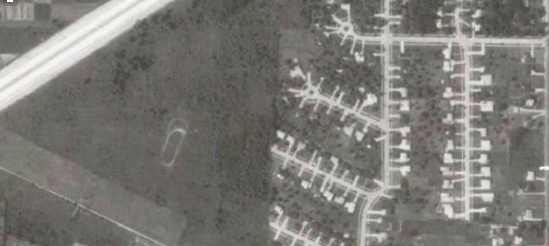
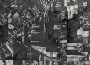
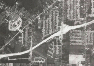 So, off we went in search of the original maps filed with the county. After an exhaustive search online, and a trip to the county offices, we were able to come up with a group of maps filed between 1965 and 1972. These maps showed the evolution of streets, homes and sidewalks in Bretton Ridge. In August 1987 the east and west ends of I-480 were connected, carving a path through the original land creating the north and south sides of the development. The maps included on this page include very cool aerial views of the development during its first 20 years.
 Many residents over the years have also asked about the evolution and creation of Cambridge Crossing and whether or not those homes are a part of Bretton Ridge. The answer is no, they are a separate development, but are always welcome to join the HOA as outside members – and use the pool and park. If you look at the way in which our development was finished, you can see a triangle of empty space just waiting for new homes. Cambridge Crossing joined the map in the late 80’s, completing the south side developments.
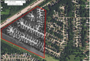
For those interested in some history of the creation of Bretton Ridge, attached to this post you will find the original plat maps filed with Cuyahoga County. These maps outline which homes are a part of the development, and where the boundaries and easements of the streets and sidewalks should be. After a good deal or research and some back and forth with the county we reached a consensus. All-in-all the development is officially comprised of 509 homes.*
As a part of our ongoing research and development for our new legal documents project, we found that there are homes on Hastings that are not included and homes on Stearns that must be counted in an ‘official’ capacity when it comes to voting. These maps are from a very interesting time in our development’s history. I hope you find them as interesting – please feel free to send us your questions and comments: board@brettonridge.com.